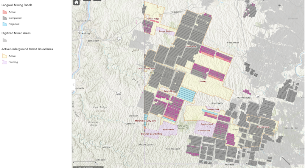
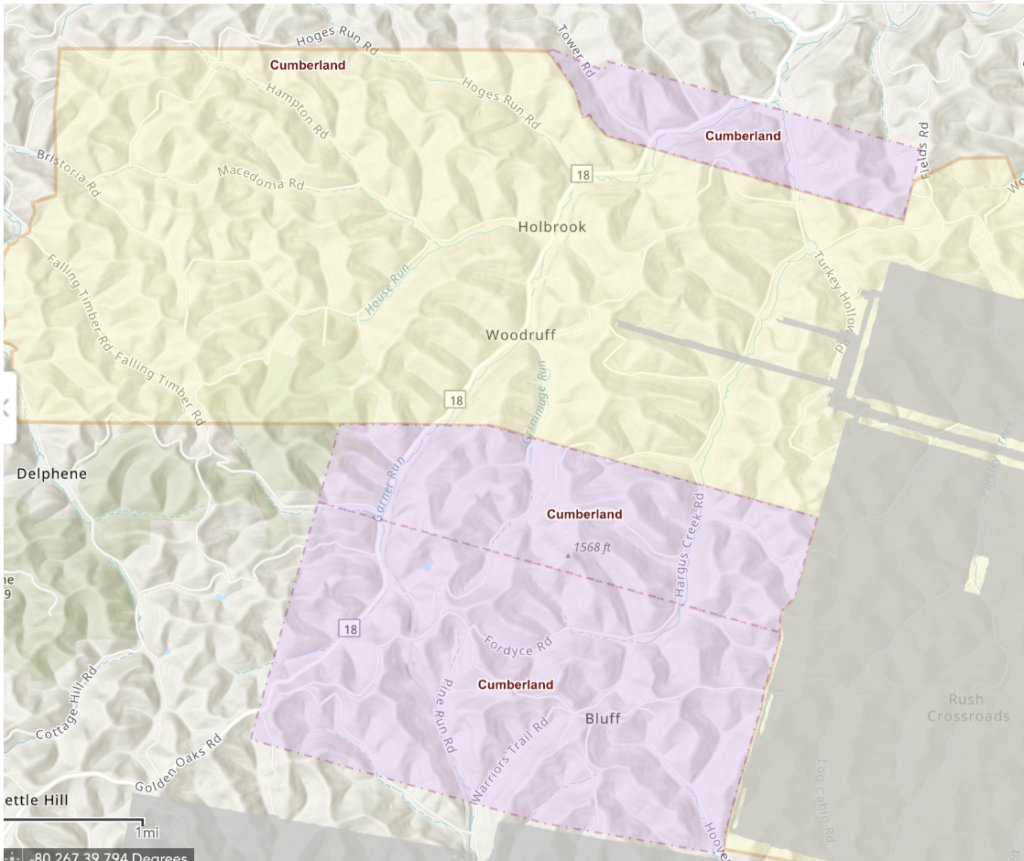
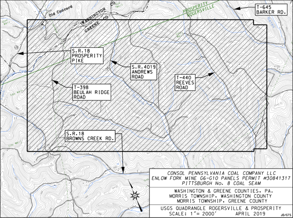
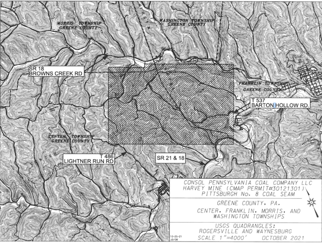
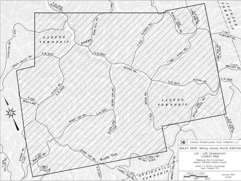
Four mining companies are currently extracting coal from Washington and Greene Counties using the underground Longwall Mining process. Consol (Bailey, Enlow, Harvey) operates three separate mines that span from Southern Greene County to Southern Washington County; Alliance (Tunnel Ridge) operates a mine in Western Washington County; Iron Senergy (Cumberland) operates a mine in Greene County; and Marshall (Marshall County Mine – West Virginia) operates in a very small area of southwestern Greene County.
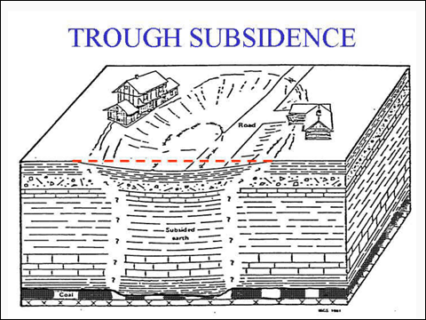
Longwall mining is a distinct coal mining practice common in Southwestern Pennsylvania; mining a longwall section involves digging through an entire panel of coal in one long swathe, then the roof of the mine falls in once the operation is done. Compared to room-and-pillar mining where blocks of coal and stone are left to hold up the ceiling, longwall mining operations have much more significant and anticipated impacts up on the surface. These huge blocks of underground coal supporting the Earth above it (what’s called the overburden) are mined out, and the tons of overburden have nowhere to go except the newly formed void left behind. When this occurs–when the ground sinks down and fills the gap left behind from the longwall–this is called subsidence.
Currently, there are over 17,000 acres (26.5 square miles) in Washington and Greene Counties with pending mining permits. Homes, streams, springs, water wells, gas pipelines, power lines, roads, active/abandoned/orphaned/unknown gas wells and much more exist on top of this land that may be undermined .
Consol has begun its permitting process for additional Coal Refuse Disposal Areas (CRDAs) to store waste material from mining. Multiple large valleys within a mile of the Bailey Coal Processing Plant are currently under consideration for this approximately 300-acre project. Valleys must be completely clear-cut to allow for the CRDA, access roads, sedimentation ponds, haul roads, and conveyors. Many of the considered sites would require Consol to purchase and decimate property from other landowners.
In March 2024, the United Mine Workers of America (UMWA) released a statement responding to a threat from Iron Senergy to close down the Cumberland Mine. This came as a surprise and alerted the community at large. On the company’s website, Iron Senergy touts its newly constructed CRDA as, “one of the most significant investments to Cumberland Mine.” This multi-million dollar CRDA investment, as well as substantial investments in their rail system, left many community members scratching their heads when they heard news of a closure. Then in late March, Iron Senergy issued a statement calling UMWA’s reports false and stated that elevated methane levels contributed to the shutdown. After being shut down for roughly seven days, Cumberland has been nearly running at full capacity (minus setbacks from the Baltimore Bridge collapse).
In other mining news, the 6th 5-year assessment of Act 54 (2018-2023) is due to be released this year. Previous assessments were completed by a third party – the 5th assessment was done by researchers from The University of Pittsburgh and the Carnegie Museum of Natural History. However, the 6th version is being done internally by the Department of Environmental Protection itself. As for who can participate, DEP’s website states, “…the Department will consider input from mining professionals,” meaning the very industry regulated by the act will play a part in assessing its effectiveness.
Political maneuvers from our elected officials who receive campaign donations from the coal mining companies sought to and succeeded in obtaining this deviation. Rising costs and a burden on taxpayers were cited as reasons for the change-up. Meanwhile, these same politicians turn a blind eye when coal companies burden taxpayers daily when damaging highways, roads, homes, water sources, and utilities. Do you think your home value is more likely to go up or down after being longwall undermined? And do you think that answer will be fairly represented in a report conducted in part by the mining industry?
I-70 Study
The results of a comprehensive longwall mine subsidence study conducted by researchers in the Swanson School of Engineering at the University of Pittsburgh were published in 2021. In 2019, the Tunnel Ridge Mine in Western Washington County began longwall mining operations on Panel 15, a section of the mine that runs underneath both lanes of I-70 near the PA/WV border. In anticipation of operations, Pitt researchers designed a study of the I-70 roadway. The $500,000 study had the goal of examining the subsidence process as it was happening using advanced equipment and continuous monitoring. This longwall mining event was also an opportunity to test a new preservation technique that attempts to prevent some of the damage that would normally result from the undermining of the roadway.
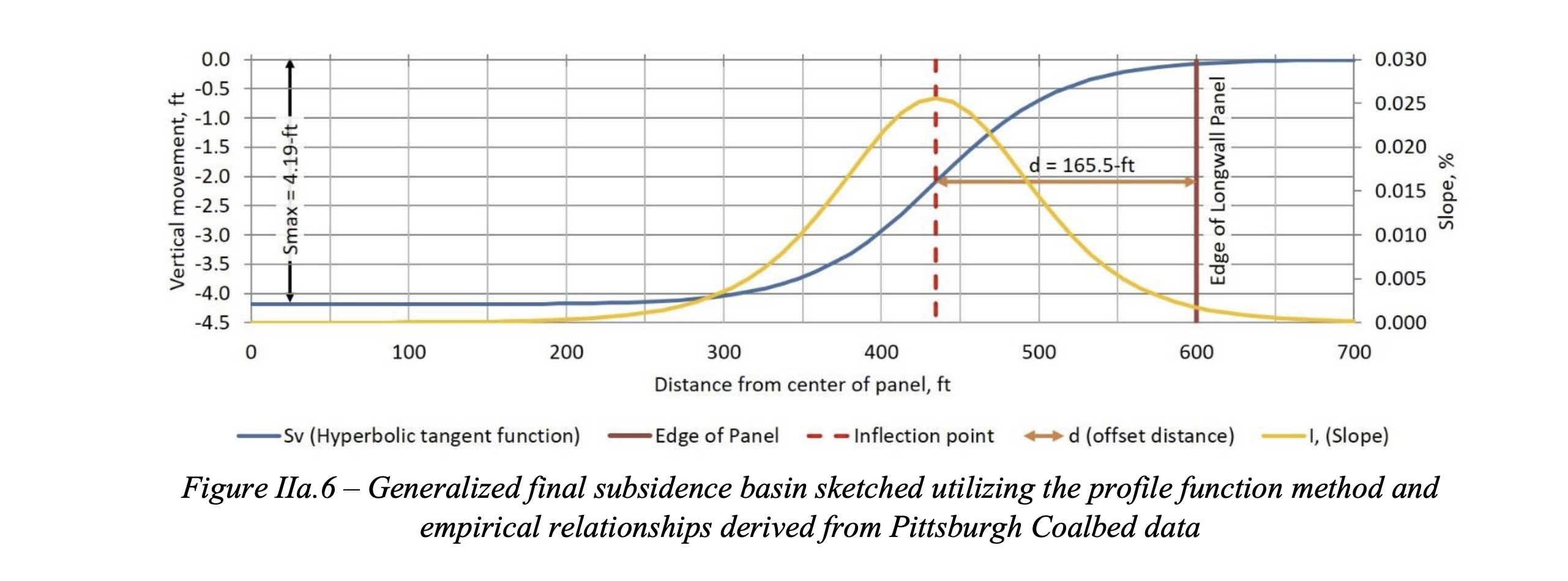
Above is a graph illustrating the process of subsidence as the Longwall advances underground. The solid red line marked as the “Edge of the Longwall Panel” represents the wall being mined out, and the red dashed line represents the point where surface goes from being under tension to being compressed: the inflection point is the red dotted line following behind the mining process where the subsidence is at its maximum slope. Put simply, these lines represent the predictable process of subsidence, and represent the tensions and slopes that are happening to the ground as it subsides due to the longwall operation.
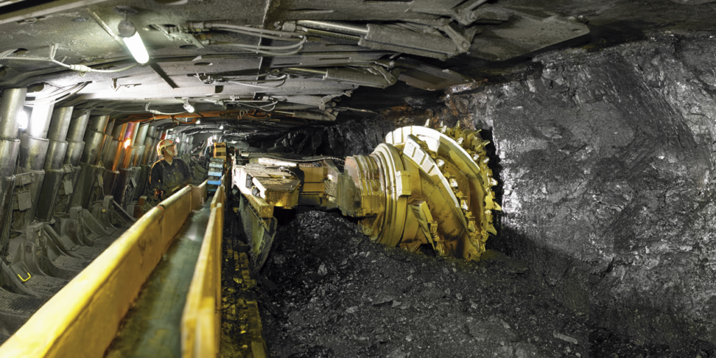
Peabody Energy, Inc., CC BY-SA 4.0, via Wikimedia Commons
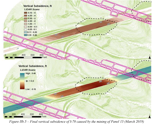
What does that subsidence look like while it’s happening? Below are some pictures from the study to document the effects that the subsidence was having on the roadway.
This is a map of I-70 showing the most severe subsidence in red. Some parts of the road sunk down more than 5 feet!
This collection of pictures shows the damage to the highway and the warping of the guide rails.
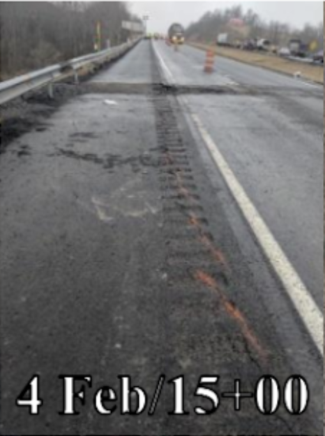
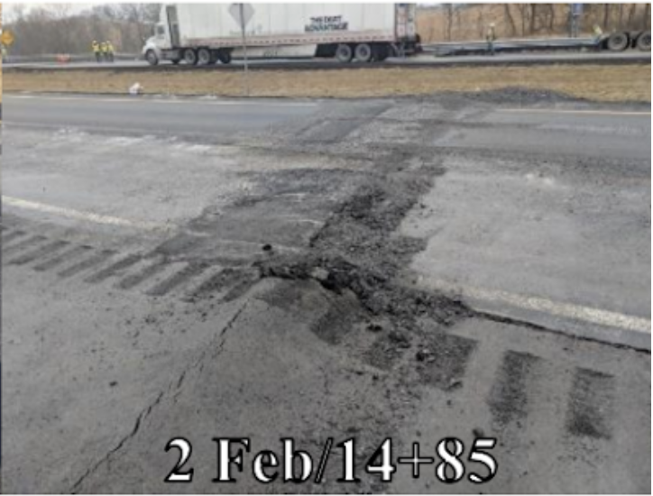
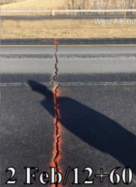
From “Identification of Factors Controlling the Development of Subsidence Impacts Forecasting Methodology of the I-70 Alignment over Longwall Mining of the Tunnel Ridge Mine, Washington County, Pennsylvania,” by E. Adelson, A. Iannacchione, M. Li, L. Vallejo, J. Vandenbossche, and R. Winn, 2021, Appendix C. Task 3 Report, pg. 171.
The study clearly shows that Tunnel Ridge caused significant damage to the highway, and multiple lanes of traffic were forced to be monitored, repaired, and delayed for weeks after. The significance of these bumps and cracks may not seem severe, but considering this is a major transportation route where people travel at highway speeds, driving over a bump like that could be catastrophic. The cost to repair the highway wasn’t discussed within the study, but regardless the mine themselves were not held responsible for it.
Subsidence as a result of mining is not uncommon in our area—in fact, it’s a fairly serious and widespread problem. So much of Southwestern Pennsylvania has been undermined by some form of longwall mining underneath roads, towns, and houses that a government program had to be created to offer insurance for residents whose properties had been undermined. Pennsylvania’s Mine Subsidence Insurance program was created because of the ubiquity of this issue, and because homeowner’s insurance was not willing to cover the sort of damages resulting from subsidence. However, the Mine Subsidence Insurance program doesn’t help those who are being impacted by Longwall mining operations.
Online Maps and General Areas of Proposed mining
Online maps:
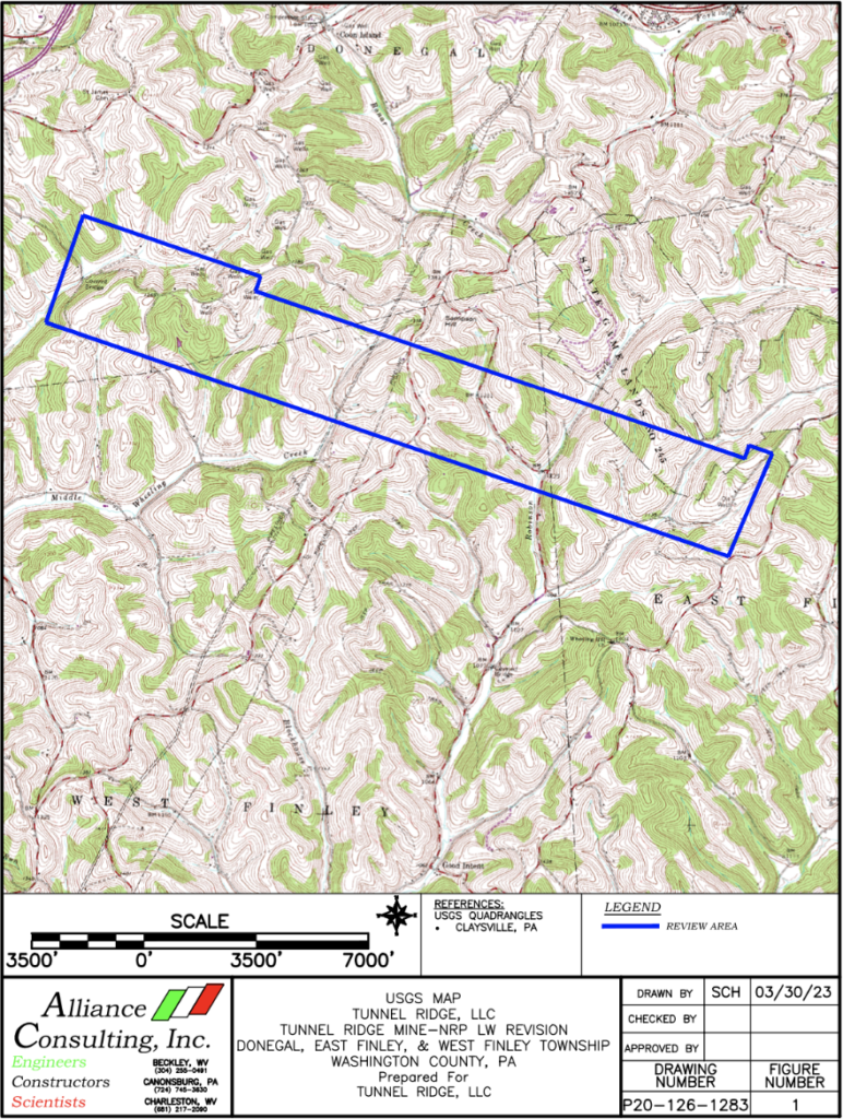
PADEP MAP – shows all active, completed, and projected longwall mining panels in PA. Any address can be searched to see where it is located in relation to any longwall mining panel. Below are recent updates that can be found using this tool.
Areas of proposed mining:
Coal Mining Resources:
- Center For Coalfield Justice Landowners’ Guide to Subsidence Damage Repair and Water Supply Replacement
- for hard copies, send us an email or print from the CCJ website (resource page)
- PA-DEP mining map showing past, current and planned areas
- Penn State Mining Maps
- Online resource that contains actual permit files
- Mainly older maps and applications
- ASK CCJ for a Coal Mining Know Your Rights Event

I’m sorry, did I read that right that the mining companies aren’t being held financially responsible for this damage and instead private landowners and the public are?
What the….
Damages to homes and water sources are expected and anticipated outcomes from longwall mining. The coal company is responsible for fixing these damages, and most longwall damages to structures occur relatively quickly. Damages to water sources can take longer to present themselves. This is really difficult when water sources are lost and city water isn’t available, or if there are wells, springs, streams, or ponds on a property that go dry and can’t be replaced or fixed after the property owner has already negotiated with the company. Structural damages do impact home values because often they aren’t fixed correctly or people don’t negotiate for enough to properly fix everything. In addition, coal companies buy up land and homes before mining and they don’t take care of some of them. Various of these outcomes can have a profoundly negative impact on property values or surrounding property values.